
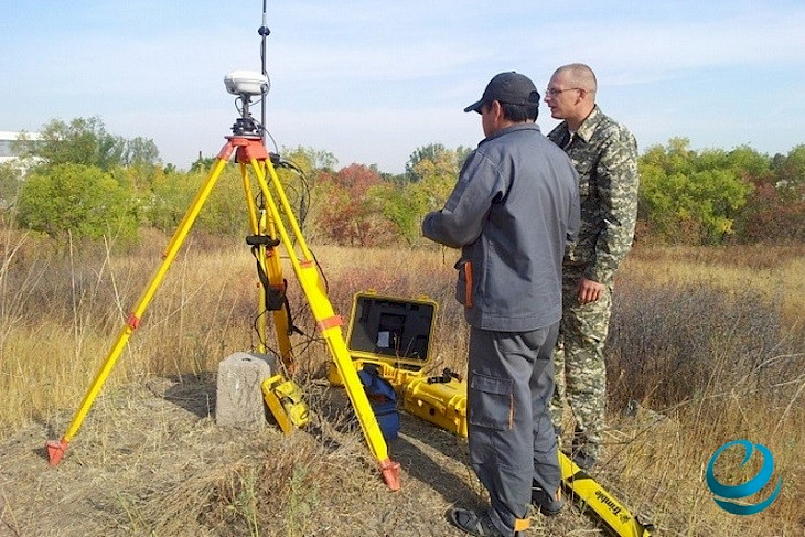
representatives of Uzbekistan and Kyrgyzstan discussed the creation of a common geodetic network and demarcation maps at the next meeting of the demarcation commission, the Ministry of Foreign Affairs of Uzbekistan informed.
Particular attention was paid to the details of the demarcation process of the Uzbek-Kyrgyz state border, including the preparation of demarcation maps using agreed geodetic data.
The establishment of such a network will be an important step towards achieving the final delineation of territories between the two countries.
The negotiations took place in the city of Osh under the auspices of friendship and mutual understanding between the two states.
At the end of the negotiations, the parties signed a corresponding protocol, agreements reached were recorded, and the results of work in 2023 were summarized.
The next meeting of the joint demarcation commission is planned to be held on the territory of Uzbekistan.
Deepening mutually beneficial cooperation on delimitation and demarcation of borders will ultimately resolve all existing disagreements and lay the foundation for strengthening good neighborly relations between the two fraternal peoples.
It is worth noting that Kyrgyzstan and Tajikistan have also been conducting negotiations on demarcating state borders in recent years.
Last year, 15 meetings of topographic groups from Tajikistan and Kyrgyzstan were held, during which approximately 170 km of border lines were agreed upon. This was reported earlier during a press conference by the Chairman of the State Committee for Land Management and Geodesy of Tajikistan, Arif Hodzoda.
The leadership of both countries is making efforts to resolve the issue as soon as possible. In total, the Tajik-Kyrgyz border is about 987 km long. Of these, approximately 890 km of the state border have already been agreed upon.
CentralasianLIGHT.org
March 13, 2024